Current listings
There is not enough active Box & Atlas inventory in this suburb to describe a reliable current view.
Bulawayo neighbourhood guide
Kumalo is a prime low-density residential part of Bulawayo, best read through day-to-day access, stand character, and the practical amenities around it: schools, medical facilities, sports clubs, shopping, and short CBD access.
Kumalo is a prime low-density residential part of Bulawayo, best read through day-to-day access, stand character, and the practical amenities around it: schools, medical facilities, sports clubs, shopping, and short CBD access.
Search interest in Kumalo is not limited to houses. Buyers may compare houses, townhouses, land, stands, and commercial property depending on budget, paperwork, road access, services, and how close the listing sits to schools, shops, clinics, fuel, churches, sports facilities, and commuter routes.
Older city mapping places Kumalo close to Northend, Queens Park West, Sauerstown, Parkview, Hume Park, Suburbs, Barbourfields, Makokoba, Highmount, and the city core, which supports its strong central residential search intent.
Kumalo is named after the royal clan of the Matabele; the Kumalo hockey stadium is located there.
Bulawayo is Zimbabwe's second largest city and the largest city in Matabeleland. Its CBD is surrounded by numerous suburbs, and the city has long-standing education, rail, industrial, museum, sporting, and cultural institutions that shape buyer demand across neighbourhoods.
Bulawayo sits on a Highveld plain, and the wider city shape explains why buyers often compare suburbs by slope, stand size, river/stream naming, CBD access, and the older east/south residential corridors.
Older city references are useful for neighbourhood research because they show how Bulawayo grew from the CBD into northern, eastern, southern, western, industrial, and high-density residential corridors. The 1992 guide is especially useful for suburb-map variants, flats/building names, hospital-era landmarks, and transport/tourism context, but current amenity and service claims still need live verification. Current listing stats come from Box & Atlas inventory.
Area context is cross-checked against public neighbourhood references, historical suburb-name notes, older city guide maps, and the live Box & Atlas listing catalogue.
Market signals
There is not enough active Box & Atlas inventory in this suburb to describe a reliable current view.
No current listing in this suburb is less than 30 days old in the available data.
Price-per-square-metre context is limited because size data is not consistently available for this suburb.
Bedroom-mix context is limited because the active data is small or land/commercial-heavy.
No active price-change signal is currently recorded for this suburb.
These signals use active Box & Atlas listing data and should be read as market context, not a formal valuation. Smaller listing sets can move quickly when one property is added, removed, refreshed, or sold.
Compare nearby options
prime low-density residential area with 0 active listings and Not enough data median price.
prime low-density residential area with 0 active listings and Not enough data median price.
quiet low-density residential area with 0 active listings and Not enough data median price.
leafy low-density residential area with 0 active listings and Not enough data median price.
low-density edge residential area with 0 active listings and Not enough data median price.
premium low-density residential area with 0 active listings and Not enough data median price.
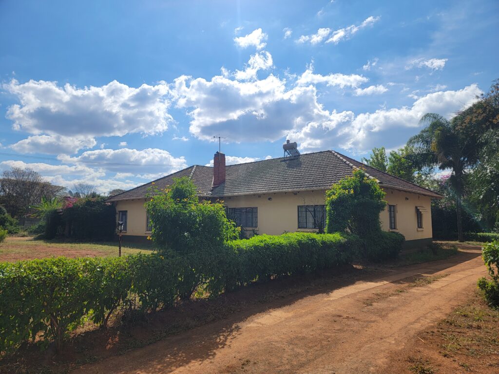
House for Sale in Kumalo – Prime Location! A solid family home situated in the...
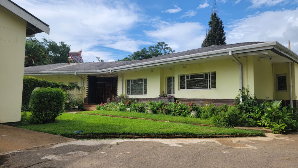
Just Listed in Khumalo, Bulawayo Asking $295k 4 Beds | Master Ensuite | 2 Bed...
This property has been sold. Enquire with Box & Atlas for details on similar current opportunities and comparable market guidance.
Explore nearby pages